
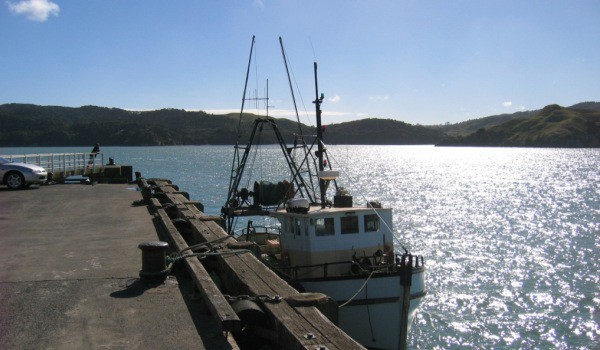
Raglan’s wharf at the end of Wallis St is a working wharf, used by fishing, charter and tour boats as well as the Raglan Coast Guard. For recreational fishos, the wharf is a popular spot for line fishing. Adjacent to the wharf is a launching ramp suitable for large trailer boats.
Boats head out over the harbour bar for snapper at the Bar Reef, with kahawai and gurnard at the 40m mark in the Tasman Sea. Tuna, marlin and kingfish are usually caught further out.
Boating Weather Forcast
Raglan Shelf Break, west of Raglan Harbour Entrance – Raglan Harbour entrance and Tasman Sea offshore
| — |
| The above rating provided by MetOcean is a guide to determine how pleasant boating conditions are likely to be. It is not a substitute for using all available sources of information for the purpose of safety. | |
| 10 |
A green rating (7 to 10) indicates calm waters, with little or no wind, and swell height under a metre. |
| 5 |
An orange rating (4 to 6) indicates average boating conditions, light-fair winds, and a swell height of 1-2 metres. |
| 1 |
A red rating (1 to 3) suggests poor and possibly dangerous conditions such as strong winds and a big swell height 2-3 metres plus. |
| ? |
A blue question mark indicates no rating available. |
[ad name=”Google Adsense”]
Raglan Harbour Entrance Chart
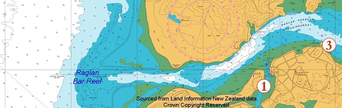
Raglan Whaingaroa Harbour Chart
| Chart No: | NZ 4421 |
| Title: | Raglan Harbour |
| Scale: | 1:12500 |
| Published: | 10/1978 |
| New Edition: | 7/2001 |
The above image is a section of chart NZ 4421 showing the Raglan Harbour Entrance and the adjacent offshore area. Data viewed or downloaded from this web site is not equivalent to or a replacement for the Official Charts, Notices to Mariners, Tide Table, Light List and Nautical Almanac as specified in Maritime Rules Part 25 Nautical Charts and Publications (pursuant to Section 36 of the Maritime Transport Act 1994). Sourced from Land Information New Zealand data. Crown Copyright Reserved.
Crossing the Raglan Harbour Bar
Watch this Waikato Regional Council video for tips on how to safely cross the Raglan Bar.
[youtube http://www.youtube.com/watch?v=dGfXlJL0WKs]
Getting to Raglan Wharf
From Bow Street, Raglan turn right into Wallis Street, keep going through the James Street intersection, past Government Road on the right and then veer round the curve and see the Wharf area. There is parking in marked spaces. You can usually find a place to park, but on peak summer weekend days, all spaces will most likely be taken. In that case you will need to turn round and park back along Wallis Street.
There are public toilets near the wharf buildings.
Wharf Launching Ramp
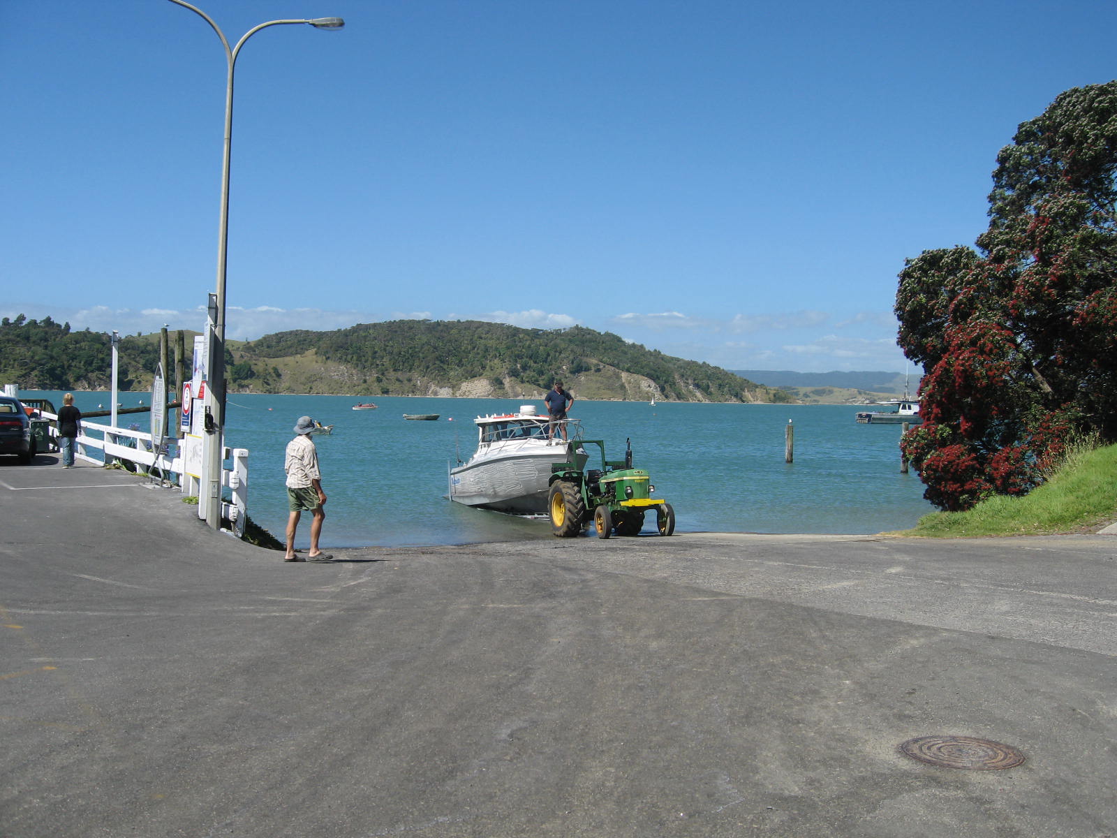
Larger boats can launch at the ramp next to Raglan Wharf at the end of Wallis Street. Launching and recovery is possible for all tides. A floating pontoon is next to the launching ramp. There is limited parking near the ramp and along Wallis Street.