
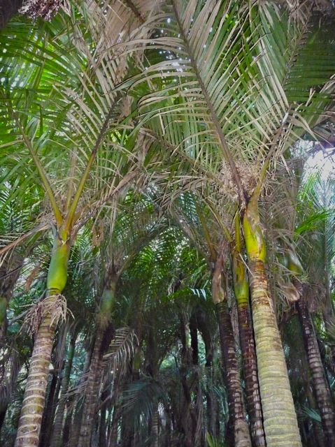
Photos taken by John Lawson on Raglan Ramblers walks in and around Raglan

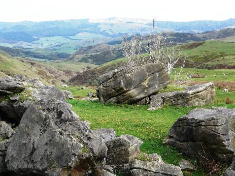
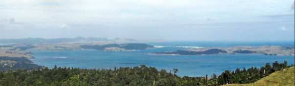
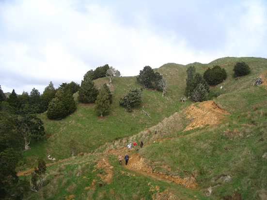
View on the walk from Old Mountain Road to Four Brothers
A different look of the 'divi' in the Four Brothers Reserve

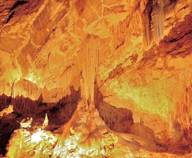
Adventure Waikato cave
Stalactites in cave at Adventure Waikato

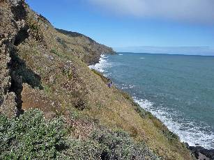
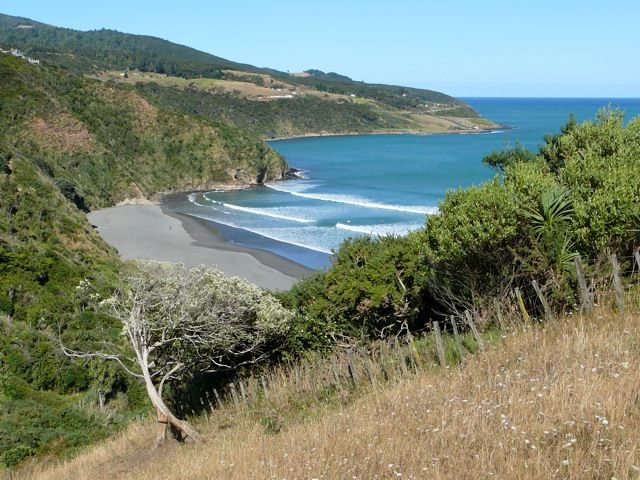
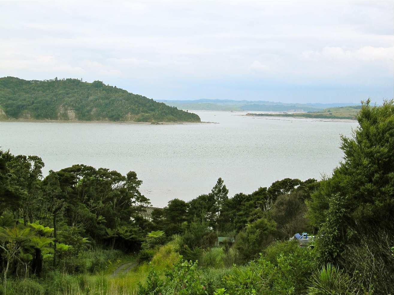
View of Te Toto Gorge
Te Toto Gorge, south west of raglan, on Whaanga Road, with coast and Tasman Sea

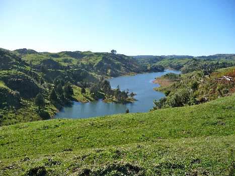
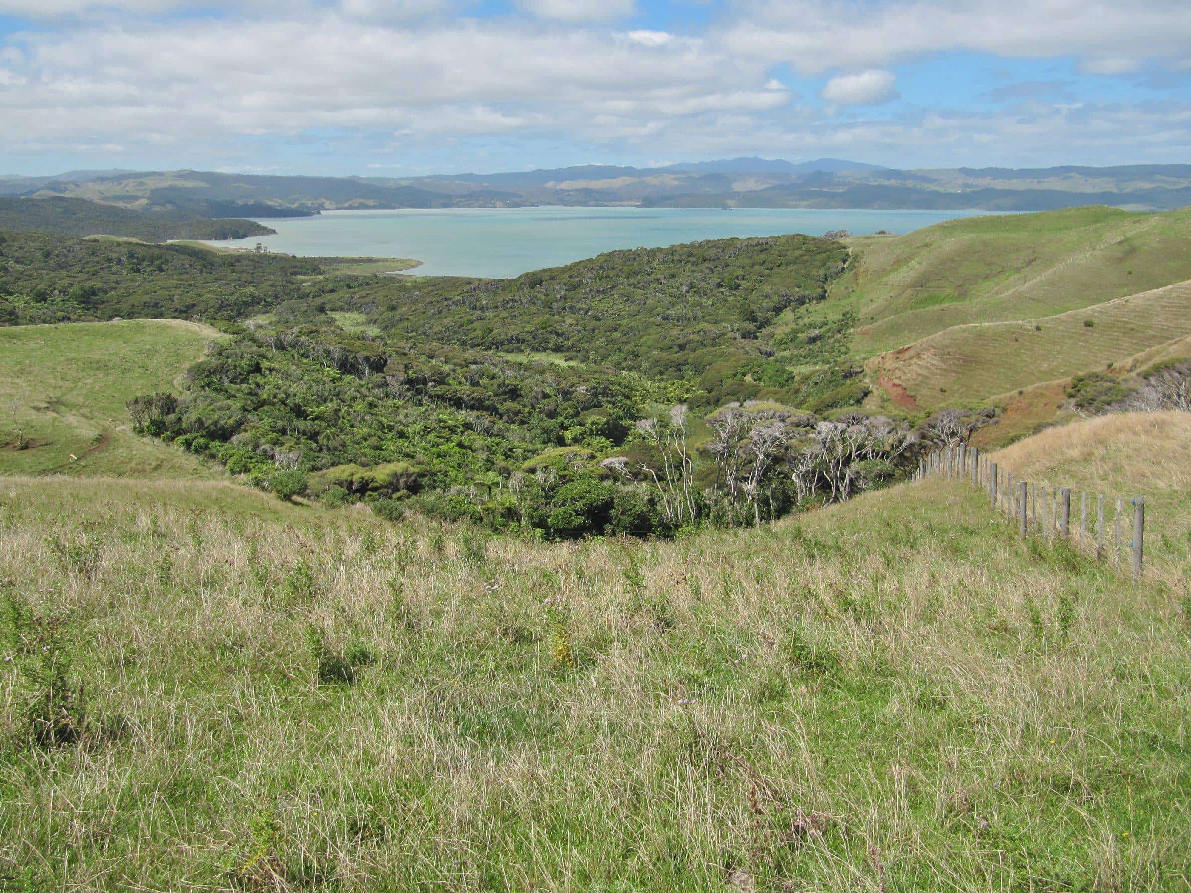
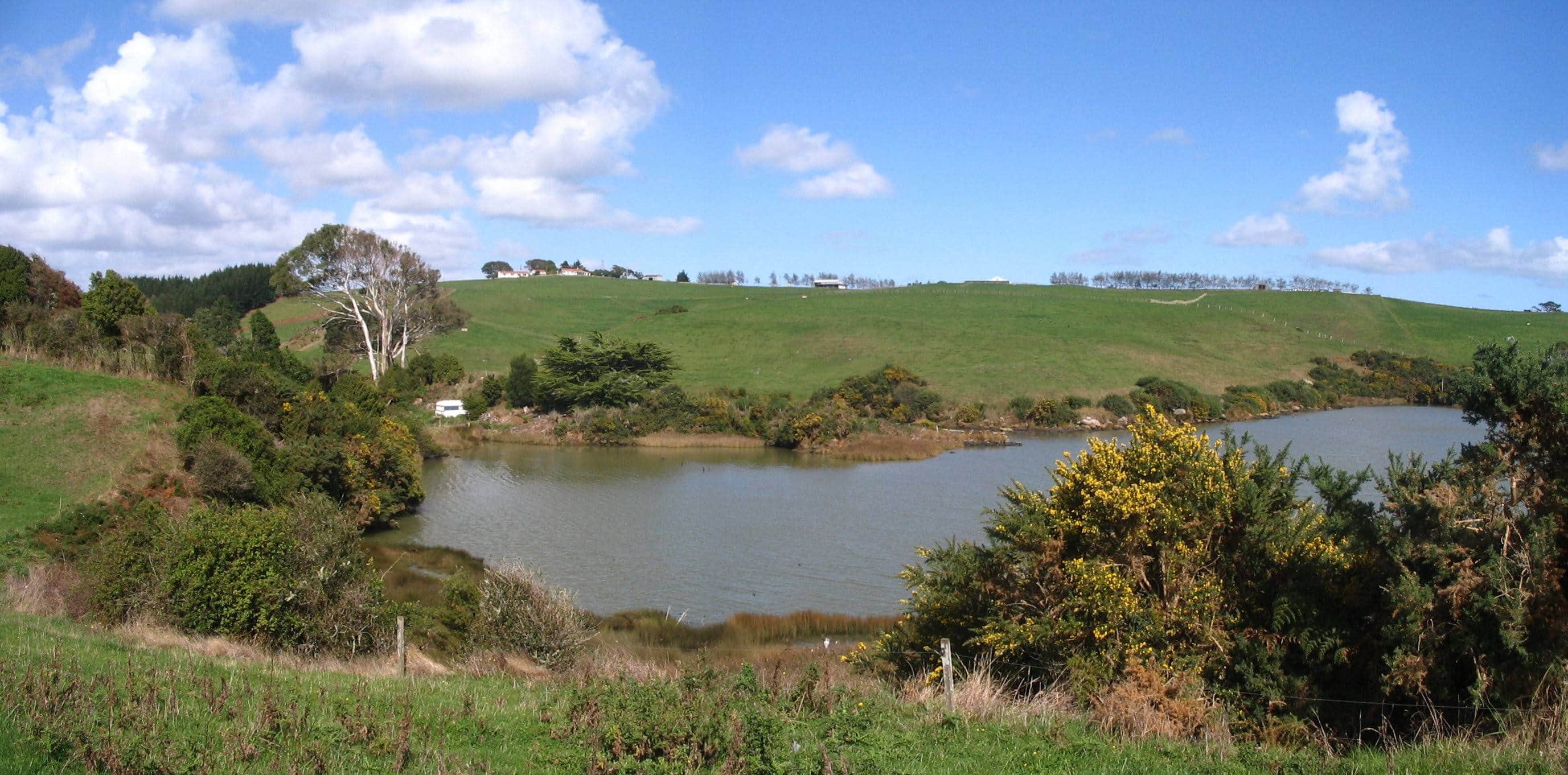
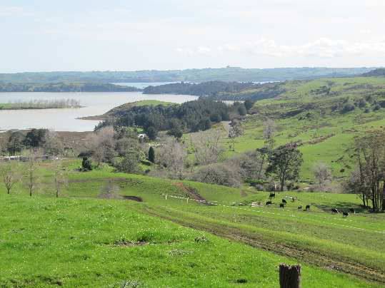
Waitetuna view
View on Coopers Creek walk at Waitetuna. there are views to Pirongia, the windfarm and Karamu.

View from magic mountain
View from magic mountain with Mount Karioi in distance. Image John Lawson

View from north of Raglan Harbour
View from north of Raglan Harbour- town to left, Mount Karioi to right. Image John Lawson

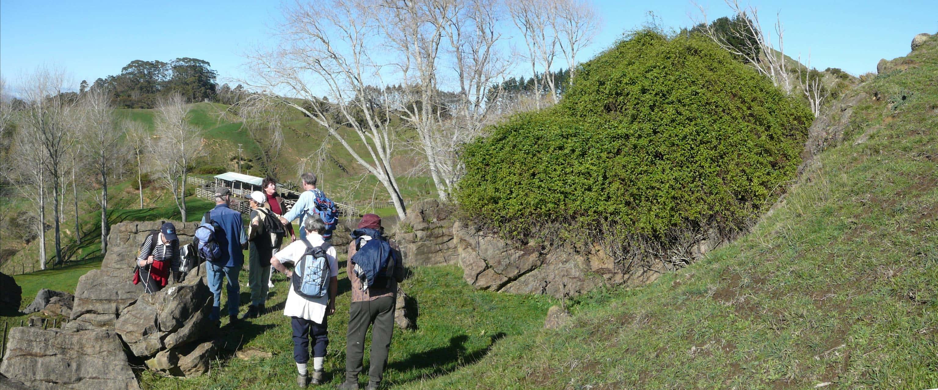
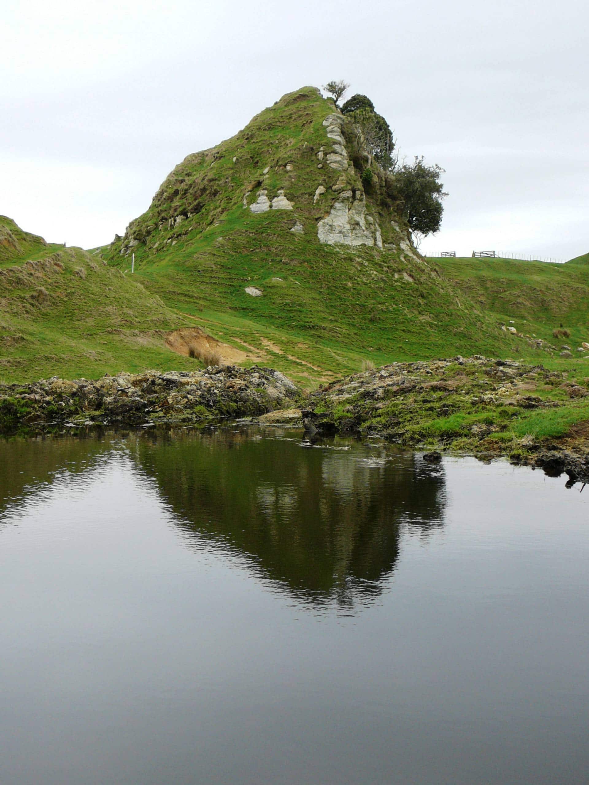
Limestone pile on Cogswell farm walk
Limestone pile on Cogswell farm walk, East of Raglan near Cogswell Road. Image John Lawson

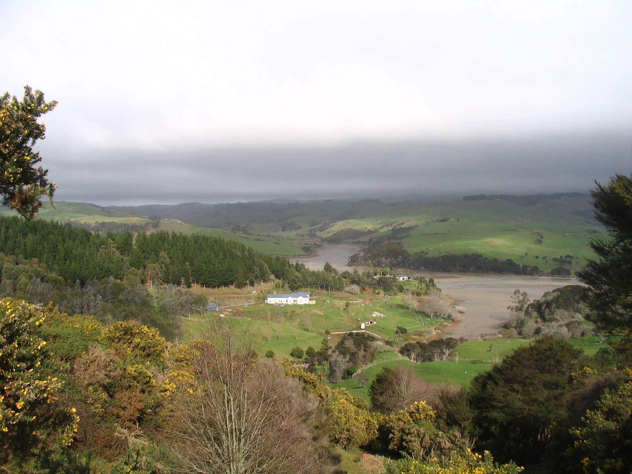
Raglan Harbour from Cogswell Road
View of the upper reaches of Raglan Harbour from Cogswell Road - Image John Lawson

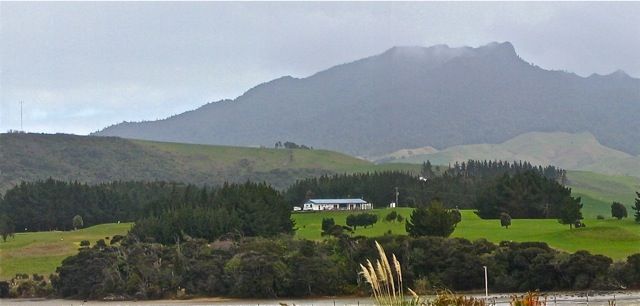
View of Mount Karioi
View of Mount Karioi from Waimaunga Rd area. Image John Lawson
 and partly buried concrete pill box gun emplacement (right) built during the Second World War.")
Wainamu Beach near Raglan Domain: Navigation beacons (left) and partly buried concrete pill box gun emplacement (right) built during the Second World War.
Wainamu Beach: Navigation beacons (left) and partly buried concrete pill box gun emplacement (right) built during the Second World War. The emplacement was one of several precautions taken in the Raglan district during the war to repel a potential Japanese attack on the harbour. Image John Lawson

Te Akatea-Pongawhakatiki. The pointed 309m hill behind Waingaro.
From the top there are views of Karioi, Whaingaroa harbour, Huntly, Kakepuku and many other hills. Image John Lawson

View across harbour of Raglan and Karioi from vicinity of Motukokako Point
View across harbour of Raglan and Karioi from vicinity of Motukokako Point

Te Mata village and hills
Te Mata village and hills

Schnackenberg Bay
Schnackenberg Bay

Raglan Harbour from Van Houtte Plateau
Raglan Harbour from Van Houtte Plateau

Turbine tower at Te Uku wind farm
Turbine tower at Te Uku wind farm

View of the part of the Hillary-Hope reserve
View of the part of the Hillary-Hope reserve

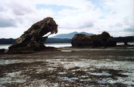
‘Hobbit’ caves at Makaka and a nearby large stack are in the 28 million year old Orahiri Limestone.
‘Hobbit’ caves at Makaka and a nearby large stack are in the 28 million year old Orahiri Limestone.

View of harbour cruise boat with Karioi in distance from Motukokako Pt
View of harbour cruise boat with Karioi in distance from Motukokako Pt

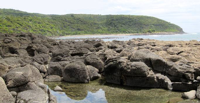
Aotea Harbour has many unique rock formations on its south shore.
Aotea Harbour has many unique rock formations on its south shore.

Raglan Wharf from Cox Bay
Raglan Wharf from Cox Bay

View of Mount Karioi from Pearts Finger
View of Mount Karioi from Pearts Finger

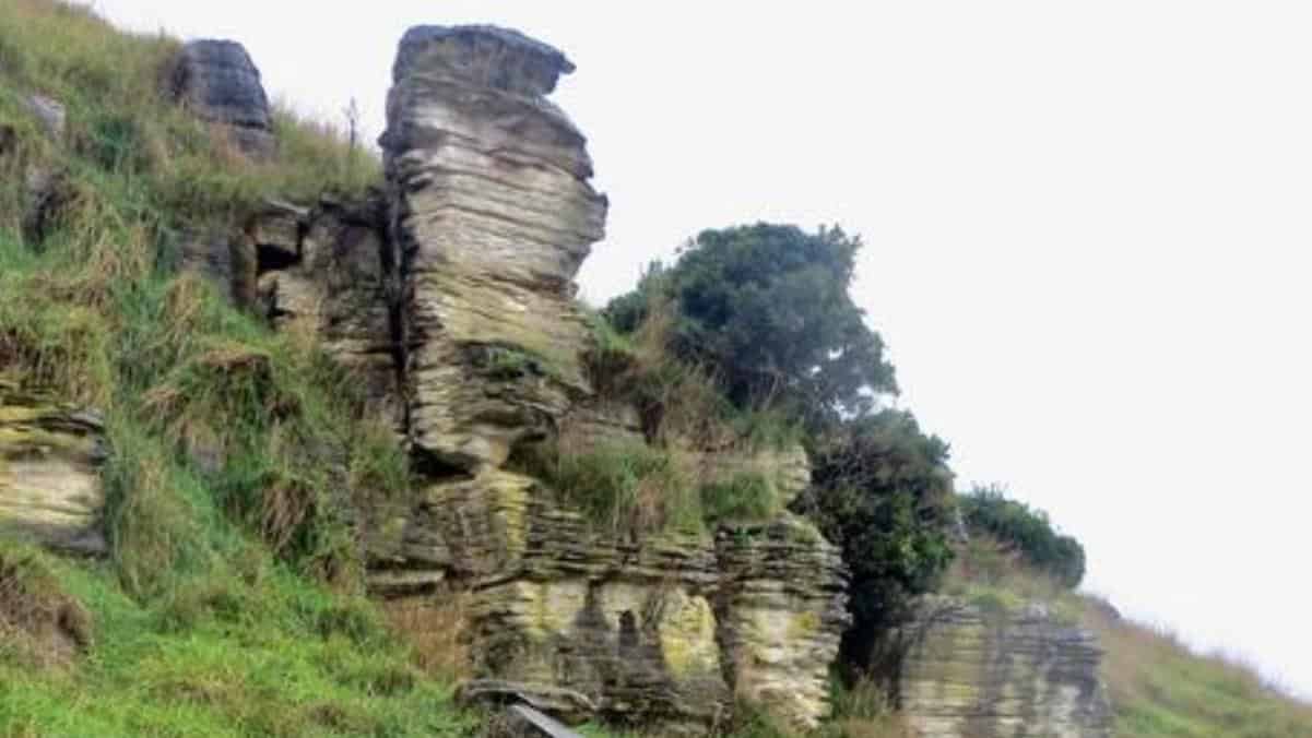
Limestone crag in the Cogswell Rd area
49 million year old Elgood Limestone forms some crags and has a few fossils. - Image John Lawson

View through two Te Akau limestone stacks across the harbour to Mount Karioi. Image John Lawson
View through two Te Akau limestone stacks across the harbour to Mount Karioi. Image John Lawson

Hills on Kauroa farm
Hills on Kauroa farm

The large Orahiri Limestone stack near Makaka
The large Orahiri Limestone stack near Makaka

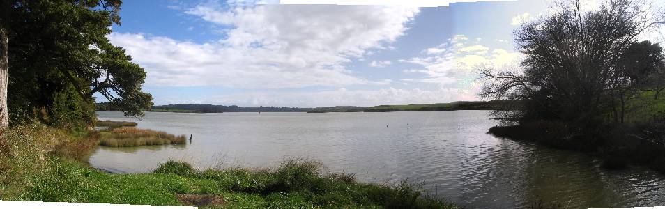
Pakoka Estuary
Pakoka Estuary

Viewing tower on Hakarimata walk
Viewing tower on Hakarimata walk

View of Hillary – Hope Reserve
View of Hillary – Hope Reserve

View of estuary and Mt Karioi from Hills Road
View of estuary and Mt Karioi from Hills Road

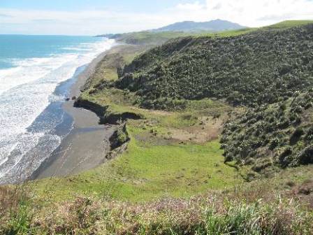
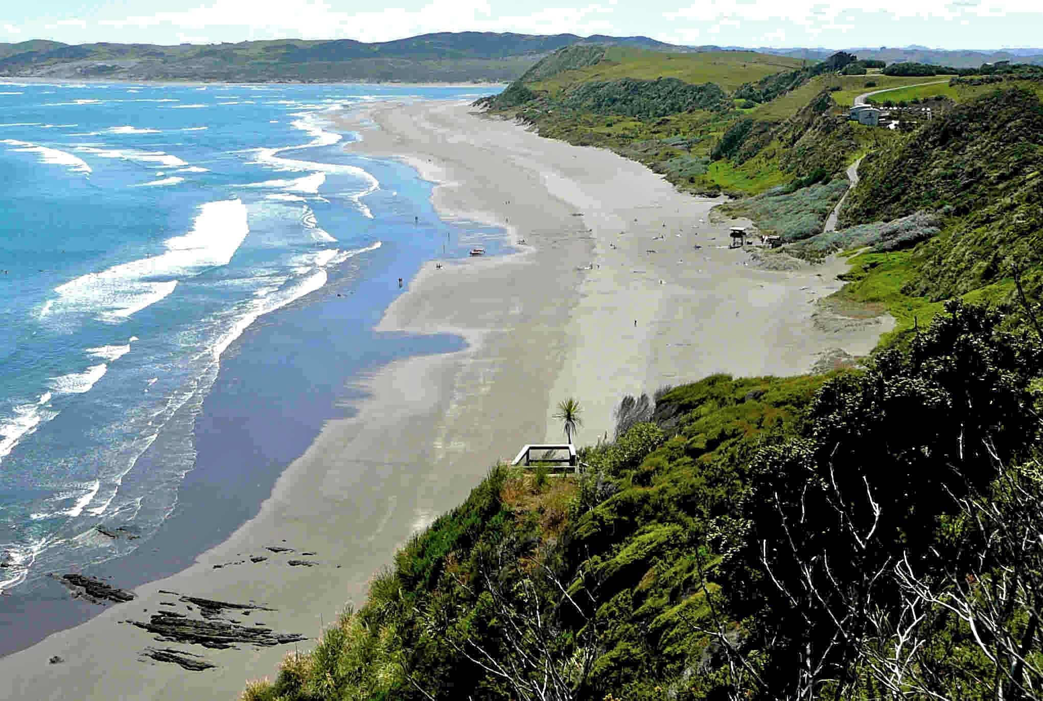
Sand dunes North of Raglan on the Tasman Sea coast
Sand dunes North of Raglan on the Tasman Sea coast

South of Waimaori Rd, Ruapuke – the north side of the large Toreparu wetland.
South of Waimaori Rd, Ruapuke – the north side of the large Toreparu wetland.

View from Waimaori Road side of Kariori
View from Waimaori Road side of Kariori

Wind-swept mapou tree near the summit of Magic Mountain
Wind-swept mapou tree near the summit of Magic Mountain

Te Toto Gorge has the most dramatic scenery on Raglan’s coast
Te Toto Gorge has the most dramatic scenery on Raglan’s coast

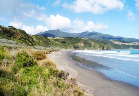
Raglan's Ngarunui Beach
Raglan's Ngarunui Beach

Old Opotoru causeway to Rangitahi Peninsula
Old Opotoru causeway to Rangitahi Peninsula

View of Raglan and the harbour from 150m high Horea
View of Raglan and the harbour from 150m high Horea

Limestone area on Te Akatea organic farm at Glen Massey
Limestone area on Te Akatea organic farm at Glen Massey
 in the middle distance.")
Aotea Harbour with small islands (Motukotuku Rocks) in the middle distance.
Aotea Harbour with small islands (Motukotuku Rocks) in the middle distance.

Ramblers stand above deep sinkhole on the Lusty Farm, Pakihi Valley
Ramblers stand above deep sinkhole on the Lusty Farm, Pakihi Valley

Pakoka Estuary – at the
north east corner of Aotea Harbour, where the water from the Waireinga falls flows to the sea, amid limestone rocks and small islets.
Pakoka Estuary – at the
north east corner of Aotea Harbour, where the water from the Waireinga falls flows to the sea, amid limestone rocks and small islets.

Kayaking over to the limestone formations on the Northern side of the harbour
Kayaking over to the limestone formations on the Northern side of the harbour

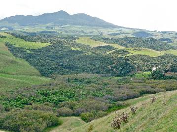
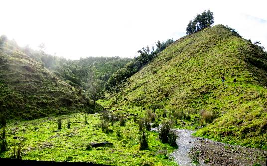
Ramblers walk towards the Mangakino Valley
Ramblers walk towards the Mangakino Valley

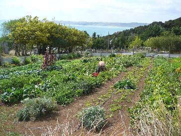
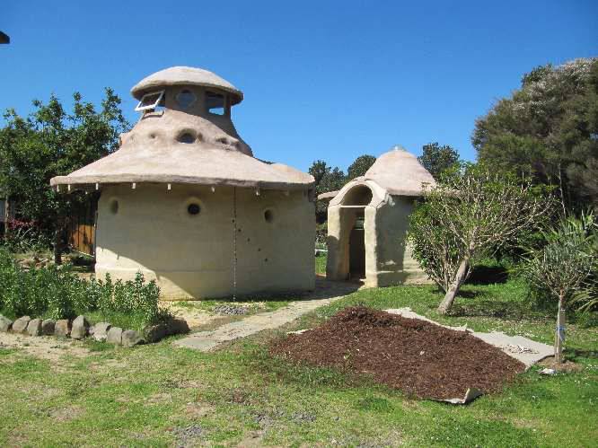
Solscape railway coach cabins and organic gardens
Solscape railway coach cabins and organic gardens

Tongariro from Mount Karioi
Tongariro from Mount Karioi

Ngarunui Beach
Ngarunui Beach

Peart's Finger and the Narrows
Peart's Finger and the Narrows

View on Divvy to Cogswell walk
View on Divvy to Cogswell walk

Te Uku wind farm tower
Te Uku wind farm tower

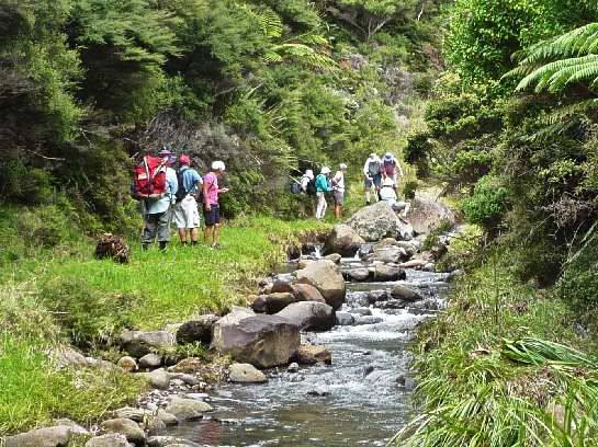
Cogswell Valley riverside walk
Cogswell Valley riverside walk

View on Whatawhata Hill Country Station walk
View on Whatawhata Hill Country Station walk

View from Mount Karioi
View from Mount Karioi

View of Raglan from Wainui Reserve
View of Raglan from Wainui Reserve

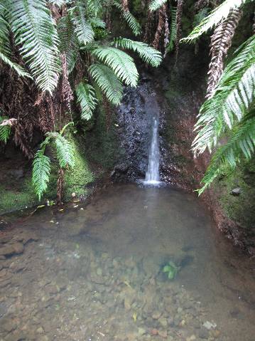
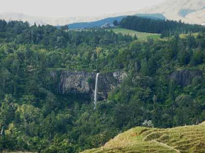
Wairenga Bridal Veil Falls
Wairenga Bridal Veil Falls

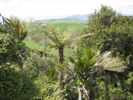
Makomako valley and bush on the 1900s partly formed road behind Aotea
Makomako valley and bush on the 1900s partly formed road behind Aotea

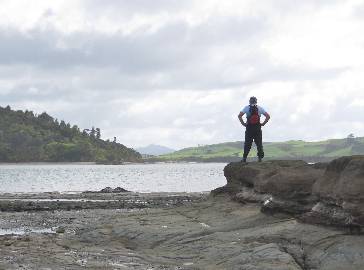
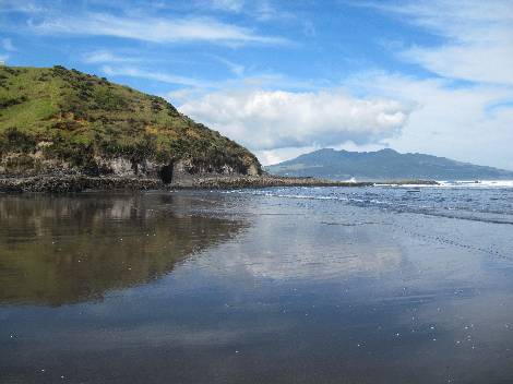
View from Mussel Rock with Mount Karioi in the distance
View from Mussel Rock with Mount Karioi in the distance

Scene on Raglan Rambler's walk on Peart's Finger
Scene on Raglan Rambler's walk on Peart's Finger

Ngarunui Beach with Raglan Harbour Bar and Entrance
Ngarunui Beach with Raglan Harbour Bar and Entrance

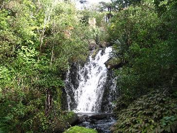
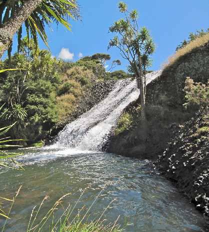
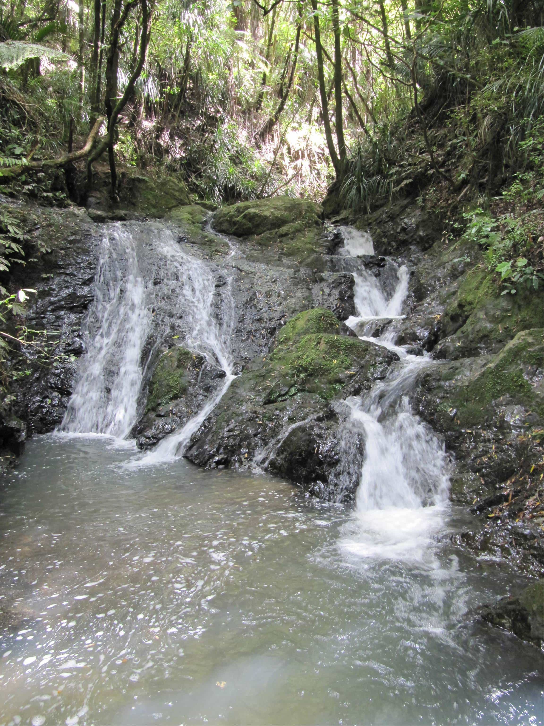
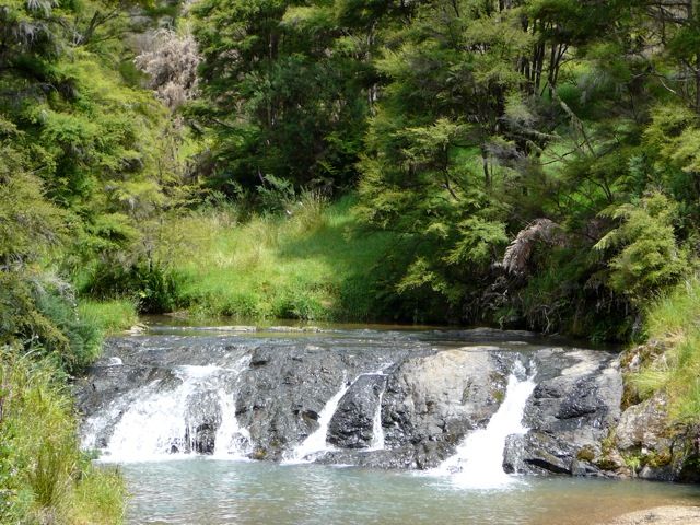
Waterfall at Toreparu
Waterfall at Toreparu

View of Waikato from the Raglan Ramblers' Glen Massey walk
View of Waikato from the Raglan Ramblers' Glen Massey walk

The fillery cliffs at Karamu
The fillery cliffs at Karamu

Good views on the Waitetuna walk from the Koheahea ridge to Pirongia and the windfarm
Good views on the Waitetuna walk from the Koheahea ridge to Pirongia and the windfarm

Raglan Views
Raglan Views

Some of the amazing rock formations along the beach and out into Aotea Harbour
Some of the amazing rock formations along the beach and out into Aotea Harbour

View from Karamu Walkway
From Karamu Walkway looking down to the summit of the deviation and across to Heretu. Image John Lawson

Mount Karioi from Till's Lookout in Dinsdale
Mount Karioi from Till's Lookout in Dinsdale

On the Hakarimata's walk is the tree-lined 1923 Mangarata reservoir,
which once supplied Ngaruawahia with water
On the Hakarimata's walk is the tree-lined 1923 Mangarata reservoir,
which once supplied Ngaruawahia with water

Ascending Karioi from Ruapuke side along the ridge
Ascending Karioi from Ruapuke side along the ridge

St Alban's Church at Waingaro
St Alban's Church at Waingaro

Schnackenberg Bay with pancake limestone arches.
Schnackenberg Bay with pancake limestone arches.

The four winds pieces that form the Whaingaroa Creative Sculptures at Wainui Reserve. The sculptures were created in 2001 and sited at Wainui Reserve in 2002. Bible Camp and Mount Karioi in background.
The four winds pieces that form the Whaingaroa Creative Sculptures at Wainui Reserve. The sculptures were created in 2001 and sited at Wainui Reserve in 2002. Bible Camp and Mount Karioi in background.

View of Peart’s Finger on the Rambler's Paretata walk.
View of Peart’s Finger on the Rambler's Paretata walk.

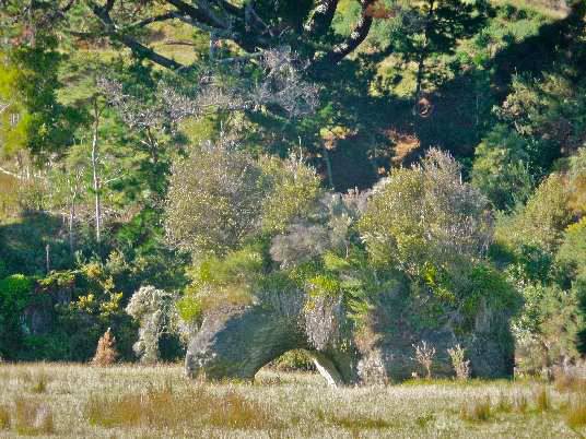
On the Peart's Finger walk, along the way look out for this totara tree with a long root
On the Peart's Finger walk, along the way look out for this totara tree with a long root

On the Te Akau Wharf Rd walk there is a tranquil creek and a couple of
waterfalls.
On the Te Akau Wharf Rd walk there is a tranquil creek and a couple of
waterfalls.

View of Raglan from Golf Course
View of Raglan from Golf Course

Te Toto Gorge
Te Toto Gorge

Kakepuku
Kakepuku

View from Karamu Walkway
View from Karamu Walkway

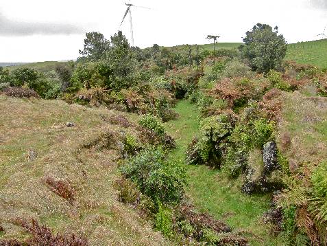
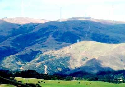
Powerline runs up from Waitetuna Valley to Wind Farm on plateau
Powerline runs up from Waitetuna Valley to Wind Farm on plateau

A view from the Raglan Ramblers walk on the south-east side of Karioi
A view from the Raglan Ramblers walk on the south-east side of Karioi

Raglan Ramblers stroll along Ngarunui Beach
Raglan Ramblers stroll along Ngarunui Beach

View from Hills' farm on Te Hutewai Rd – where the radio masts are, only 160m above Raglan but good views across harbour and coast
View from Hills' farm on Te Hutewai Rd – where the radio masts are, only 160m above Raglan but good views across harbour and coast

Toperau Waterfall
Toperau Waterfall

Te Akatea-Pongawhakatiki. The pointed 309m hill behind Waingaro.
Te Akatea-Pongawhakatiki. The pointed 309m hill behind Waingaro.

Omahina Creek
Omahina Creek

Natural arch in the valley below Bridal Veil Falls on the Pakoka River Walk
Natural arch in the valley below Bridal Veil Falls on the Pakoka River Walk

Scene on walk to Te Uku Wind Farm where the road cutting shows the partly formed road to Waitetuna started in 1908, but never completed after the First World War. Wind turbine tower in mist in background.
Scene on walk to Te Uku Wind Farm where the road cutting shows the partly formed road to Waitetuna started in 1908, but never completed after the First World War. Wind turbine tower in mist in background.

Phillips Rd area above Toperau
Phillips Rd area above Toperau

Pakoka Estuary on the Aotea Harbour
Pakoka Estuary on the Aotea Harbour

Limestone feature on Karamu Walkway
Limestone feature on Karamu Walkway

Karioi from Ruapuke Rd. Dwarf montane bush and great views
Karioi from Ruapuke Rd. Dwarf montane bush and great views

View of Kaitoke with Mount Karioi in backgorund
View of Kaitoke with Mount Karioi in backgorund

View on Ed Hillary Hope Reserve
View on Ed Hillary Hope Reserve

Inner harbour view from Peart's Finger
Inner harbour view from Peart's Finger

View from Magic Mountain
View from Magic Mountain

Mt Kakepuku - south east of Mt Pirongia
Mt Kakepuku - south east of Mt Pirongia

Schnackenberg Bay - probably the most interesting bay on this coast
Schnackenberg Bay - probably the most interesting bay on this coast

The hidden waterfalls of Rangitahi
The hidden waterfalls of Rangitahi

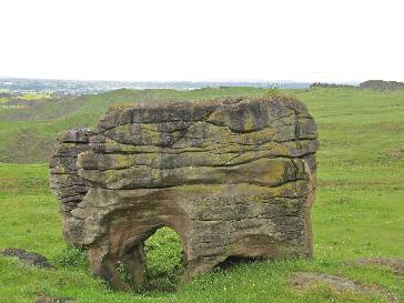
Elephant Rock on Ngarunui Beach
Elephant Rock on Ngarunui Beach

Shoreline of Aotea Harbour
Shoreline of Aotea Harbour

Stalactites in Adventure Waikato cave at Te Akau
Stalactites in Adventure Waikato cave at Te Akau

Stream at Whale Bay
Stream at Whale Bay

Kawhia Harbour
Kawhia Harbour

Solscape accommodation and gardens at Manu Bay, Raglan
Solscape accommodation and gardens at Manu Bay, Raglan

Bridal Veil Falls from Newton Rd walk
Bridal Veil Falls from Newton Rd walk

Monument to Tuaiwa Ngatipare at Patikirau on northern side of harbour opposite Raglan Wharf
Monument to Tuaiwa Ngatipare at Patikirau on northern side of harbour opposite Raglan Wharf
")
Heretu overlooking the divi (SH23)
Heretu overlooking the divi (SH23)

Limestone arch in Pakoka valley below the Bridal Veil Falls
Limestone arch in Pakoka valley below the Bridal Veil Falls

Elephant Rock on Ngarunui Beach
Elephant Rock on Ngarunui Beach

The Narrows - inner Raglan Harbour
The Narrows - inner Raglan Harbour

Te Hutewai Rd area towards Karioi. This is an area where Karioi’s bush has survived below the 200 metre contour.
Te Hutewai Rd area towards Karioi. This is an area where Karioi’s bush has survived below the 200 metre contour.

View with Karioi in distance on Mussel Rock walk
View with Karioi in distance on Mussel Rock walk

Limestone stacks on northern side of Raglan Harbour
Limestone stacks on northern side of Raglan Harbour

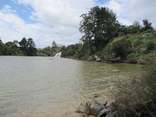
Okete Falls inlet
Okete Falls inlet

The Raglan Ramblers, Te Mata domain to Magic Mountain walk has views of Pirongia, Karioi, Aotea, Kawhia, Whaingaroa and this wind-swept mapou tree.
The Raglan Ramblers, Te Mata domain to Magic Mountain walk has views of Pirongia, Karioi, Aotea, Kawhia, Whaingaroa and this wind-swept mapou tree.

View from Waitetuna Organic Farm walk
View from Waitetuna Organic Farm walk

Glimpse of waters of the Kaitoke
Glimpse of waters of the Kaitoke

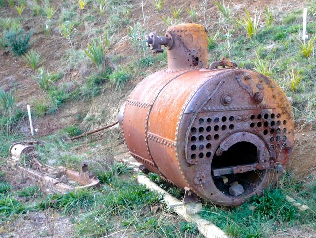
Rutherford Flax Mill boiler and Kaitoke Estuary
Rutherford Flax Mill boiler and Kaitoke Estuary

View from Wainui reserve trig station of coast line north of Raglan Harbour entrance
View from Wainui reserve trig station of coast line north of Raglan Harbour entrance

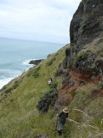
Rugged coast near Te Toto Gorge
Rugged coast near Te Toto Gorge

Kawhia Wharf and harbour
Kawhia Wharf and harbour

View from Peart's Finger
View from Peart's Finger

View from Maungatautari
View from Maungatautari

Mangroves at Waingaro Landing
Mangroves at Waingaro Landing

Estuary view on Hills Road walk
Estuary view on Hills Road walk

Mt Karioi walk
Mt Karioi walk

Ruapuke Beach
Ruapuke Beach

Omahina Creek
Omahina Creek

Sand dunes on Mussel Rock walk
Sand dunes on Mussel Rock walk

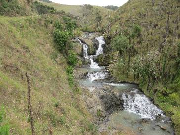
Waterfall on the Toperau walk
Waterfall on the Toperau walk

Views of Waipa River from Whatawhata Hill Country walk
Views of Waipa River from Whatawhata Hill Country walk

Views from Plateau Rd
Views from Plateau Rd

View of Raglan from Mount Karioi
View of Raglan from Mount Karioi

Hills Farm on Te Hutewai Rd
Hills Farm on Te Hutewai Rd

View right down the harbour from Ranui
View right down the harbour from Ranui

Cascades on Hakarimata walk
Cascades on Hakarimata walk

Harbour inlet on Te Akau walk
Harbour inlet on Te Akau walk

Views over the Waipa Valley on the Whatawhata Hill Country Research Station walk
Views over the Waipa Valley on the Whatawhata Hill Country Research Station walk

A craggy limestone outcrop in lower Waitetuna Valley
A craggy limestone outcrop in lower Waitetuna Valley

Flower of the banana passion vine - seen on the Kaitoke walkway in March
Flower of the banana passion vine - seen on the Kaitoke walkway in March

Pakoka estuary in the corner of Aotea Harbour
Pakoka estuary in the corner of Aotea Harbour

Site of old 1844 Aotea Mission Station
Site of old 1844 Aotea Mission Station

Limestone outcrop on Karamu walkway
Limestone outcrop on Karamu walkway

Walk above Waitetuna organic farm
Walk above Waitetuna organic farm

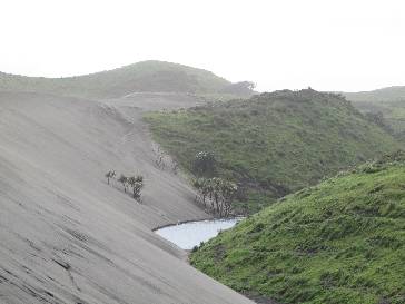
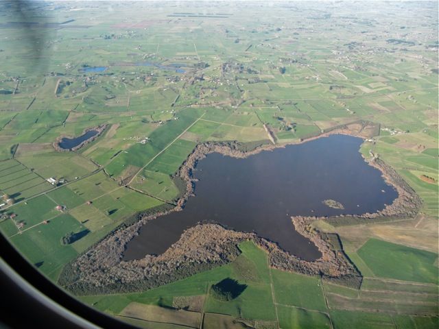
Area around Lake Disappear
Area around Lake Disappear

Elephant Rock on Ngarunui Beach
Elephant Rock on Ngarunui Beach

Pongawhakatika
Pongawhakatika

Pakoka Valley
Pakoka Valley

Opotoru Footbridge
Opotoru Footbridge

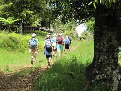
View from Old Mountain Rd of bus on SH 23
View from Old Mountain Rd of bus on SH 23

Ponganui Waterfalls
Ponganui Waterfalls

Hamilton Gardens
Hamilton Gardens

Limestone rock formations
Limestone rock formations on Northern side of Raglan Harbour- Image John Lawson

Pakoka Valley has views of Aotea harbour, and limestone cliffs.
At Pakoka Valley there is a 6km walk out on one side of the river and back on the other. Image John Lawson

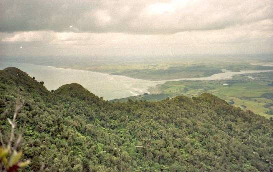
View of Ngaruawahia and Waikato River from Hakarimata range west of Ngaruawahia
Climbing the Hakarimata's, there is over 300 metres of climbing up the many steps through the bush. The reward is you will get views over Ngaruawahia and the Waikato.

View of Raglan from the Wainui Reserve
The Wainui Reserve provides access to surfing at Ngarunui Beach. There are views of Karioi, Pirongia, the coast and Raglan.

Views of Waitetuna Valley from Old Mountain Road
The Rambler's walk in the Old Mountain Rd area and is about 5km and 140m up and down to the divi over farm and through bush. There are views of the Waitetuna Valley. Image John Lawson

Cogswell Valley
Cogswell Valley is about 4km long and leads to the hills north of the divi on an area to be restored to bush. Image John Lawson

Starfish on Ngarunui beach
The sand level on Ngarunui Beach is always varying and there can be starfish, birds, or seals to see. Even a sea snake has been seen on this beach. Image John Lawson

Opotoru waterfalls
Opotoru waterfalls close to Raglan - Image John Lawson

View on Pakoka walk
View on Pakoka walk

Whaingaroa Whitebait Farm
Whaingaroa Whitebait Farm

View from Kaitoke track
View from Kaitoke track on edge of estuary with Mount Karioi in the distance

1942 'Type 22'
pillbox on Wainamu Beach
This pillbox, near the Kokiri Centre is almost completely covered in sand. It was built in 1942 as part of the wartime invasion defences around Raglan. Image John Lawson


Above Otonga Valley to Whaingaroa Harbour
Above Otonga Valley to Whaingaroa Harbour

Inner harbour view from Paritata Peninsula
Inner harbour view from Paritata Peninsula

Ruapuke Beach
Ruapuke Beach

Pearts Finger
Pearts Finger

Paritata peninsula
Paritata peninsula

Pakoka Valley
Pakoka Valley

Te Uku wind farm
Te Uku wind farm

Schnackenberg beach
Schnackenberg beach

Pond Road area
Pond Road area

Pakoka
Pakoka

Aotea Harbour
Aotea Harbour

Mussel rock, Te Akau
Mussel rock, Te Akau

Pongawhakatiki
Pongawhakatiki

Ruapuke
Ruapuke

Te Akau
Te Akau

Limestone rock formation on Karamu Walkway
The Karamu walkway is about about 12km
along the ridge, past karamu trees, a limestone arch, rocks and caves, with good views over the Waikato and Whaingaroa. Image John Lawson

Houchen Rd
Houchen Rd

Ruapuke beach
Ruapuke beach

Kaiwhenua gardens
Kaiwhenua gardens

Pongawhakatika
Pongawhakatika

Okete waterfalls
Okete waterfalls

Omahina
Omahina

Cogswell
Cogswell

Basalt dyke
Basalt dyke

Aotea
Aotea

Opotoru
Opotoru

St Alban’s Church, Highway 22, Waingaro
St Alban’s Church is a fine example of the simple Gothic Revival Church erected throughout Victorian and Edwardian New Zealand. A pleasing, refined design both within and out, built in 1907, it is also sited in a most picturesque setting which enhances its appeal.

View of Raglan from Te Akau Wharf Road
View of Raglan through kanuka trunks across harbour from Te Akau Wharf Road

Ruapuke's Waiau Beach
Ruapuke's Waiau beach There is a steep track to the beach, then easy walking to the Toreparu Stream and Matawha Point.

Okete Falls
Okete Falls on edge of Raglan Harbour- Image John Lawson

Natural arch by Pakoka River
Natural arch by Pakoka River.. The rocks are mainly late Whaingaroan Ahirau
Sandstone formed about 28 million years ago. Although classified as sandstone, it looks more like limestone

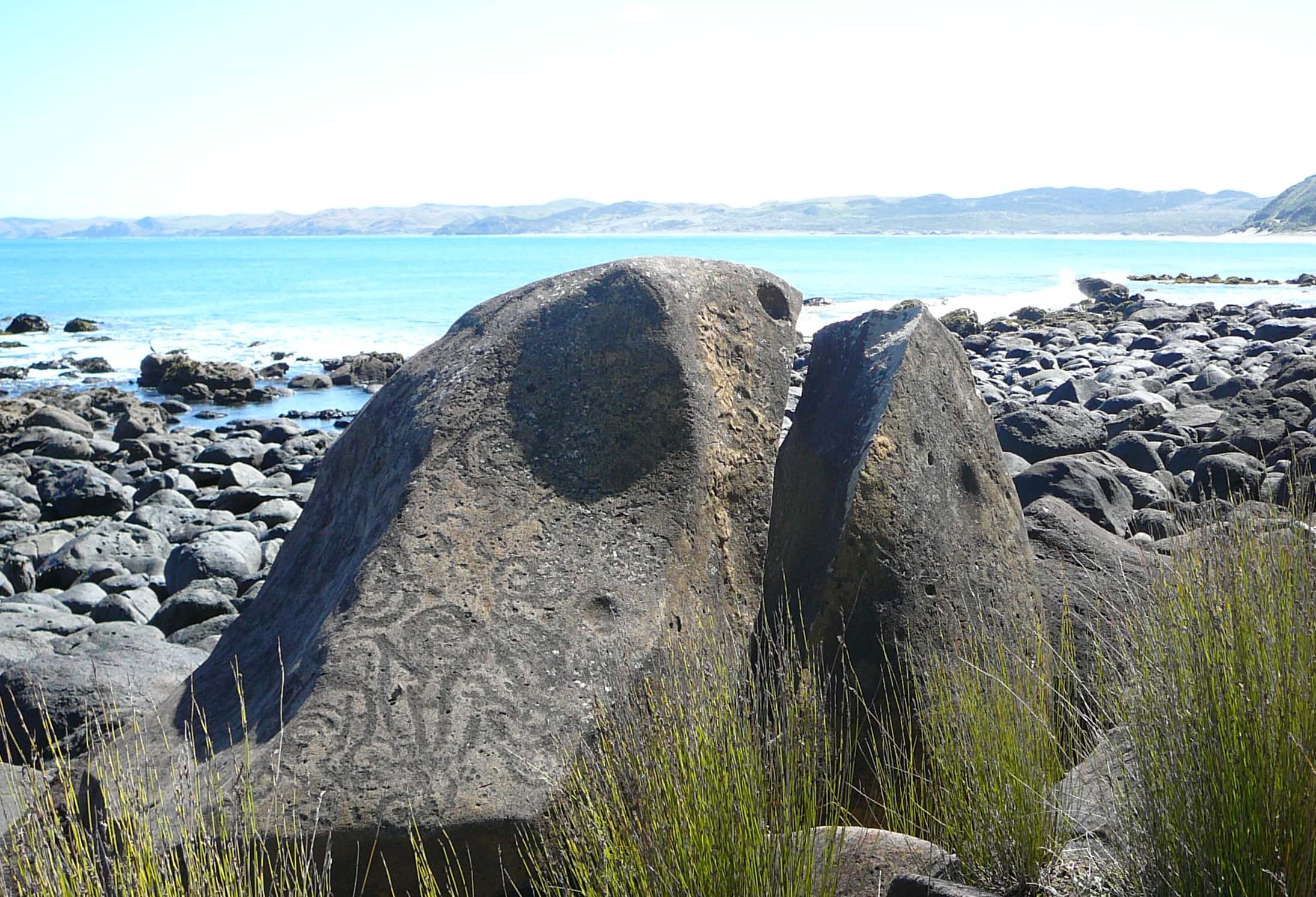
Rock formation on southern shore of Aotea Harbour
One of the many unique rock formations on Aotea Harbour’s south shore – Image John Lawson.

Ruapuke beach - Northern end
Ruapuke beach - Northern end with part of Papanui Point on right - Image John Lawson

Te Akatea-Pongawhakatiki, the pointed 309m hill
behind Waingaro.
Te Akatea-Pongawhakatiki, the pointed 309m hill
behind Waingaro, made of Pongawhakatiki siltstone about 188 million years ago (Ururoan). From the top there are views of Karioi, Whaingaroa harbour, Huntly, Kakepuku and many other hills. Below
is an area of regenerating bush in the middle of an organic farm. Image John Lawson

On the Cogswell Rd to divi walk you get some good views.
This walk goes up and down about 140 metres. Across the valley from SH 23, the tree planting in the 460 ha Ed Hillary Hope Reserve can be seen and there are other good views

View of Raglan from Te Hutewai Rd – where the radio masts are
At Te Hutewai Rd – where the radio masts are, at 160 metres above Raglan, there are good views across harbour. Image John Lawson

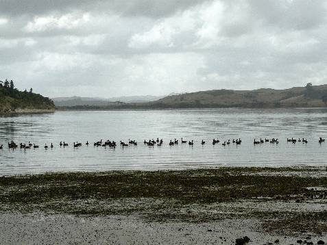
Toreparu area showing wetland.
Toreparu area, North of Aotea Harbour with the second largest coastal wetland in North Island. Image John Lawson

Rocks on Ngarunui Beach
Raglan has 6 kilometres of sand to walk along, stretching from town to the Bryant Reserve. As storms erode it and currents and winds build it up, it’s always changing; sometimes nearly all sand, at other times with many more rocks.. Image John Lawson

Pakoka Estuary
Pakoka Estuary on edge of Aotea Harbour - Image John Lawson

The walk to the wind farm from Van Houtte Rd runs along a ridge.
The track from Van Houtte Rd runs 7km along the ridge through
the centre of the wind farm. Little remains of the bush which covered this plateau before Benoit Vanhoutte arrived in 1897. There are good views of the surrounding hills and harbours. Image John Lawson

Kakepuku, rising from the plain near Te Awamutu
Kakepuku is in a line of volcanoes with Karioi and
Pirongia. Image John Lawson

Whale Bay, south west of Raglan
Rocky Beach at Whale Bay - Image John Lawson

Raglan from north side of harbour
On the Raglan Rambler's 5 km walk to Te Kaha there are views all along the way including this one of Raglan and the inner harbour

Exploring Raglan Harbour by kayak
Weathered limestone columns on northern side of Raglan Harbour - Image John Lawson

The Kaitoke walkway starts near the Raglan Area School’s wind turbine.
The Kaitoke walkway is a fairly easy local walk of about four kilometres.
Starting near the Raglan Area School’s wind turbine it follows the creek to Flax Cove, where a Cornish boiler remains from George Rutherford’s 1902 flax mill.
Image John Lawson

View of ridge on Mount Karioi
View from Mount Karioi with Whaingaroa Harbour and Raglan town in background. Image John Lawson

Te Mata countryside with Mount Karioi on horizon
The Te Mata farm walk goes through rolling country and woodlands. Along the way there is this view of Mount Karioi. Image John Lawson

Rock formations - Aotea Harbour
Some of the amazing rock formations on the southern beaches of Aotea Harbour. Image John Lawson

Trig station at Te Mata near Raglan
There are views of Pirongia, Karioi, Aotea, Kawhia and Whaingaroa from the trig station. Image John Lawson.

WW2 1942 ‘Type 22’ pillboxes on Wainamu Beach close to Raglan Domain.
One of the two 1942 ‘Type 22’ pillboxes built during the second world war as part of Raglan’s defences against invasion. Both pillboxes have have sunk into the sand, the one nearer the bar more than this one which is on Wainamu Beach close to Raglan Domain. Image John Lawson

Beach on Peart's Finger
Raglan Inner Harbour Beach on Peart’s Finger. Image John Lawson

Checkley Road area of Okete
Farm landscape in Checkley Road area of Okete, north of Te Uku. Image John Lawson

View from Karamu Walkway.
The Karamu Walkway to Limeworks Loop Road, goes up on top of the ridge for an 11 kilometre walk featuring a limestone arch, a tomo, bush and views to Waikato, Pirongia and Whaingaroa. Image John Lawson

Hillary Hope Reserve, East of Raglan
This remnant of native bush, between Old Mountain Rd and State Highway 23, has been protected as a reserve since its opening in 2015. It is being replanted by the Native Forest Restoration Trust. Image John Lawson

Te Mata farming scene with glimpse of mountain
Raglan Rambers walks on Te Mata farms are often a surprise. The Ramblers says that their Te Mata farm visits are always something of a mystery tour, although there are always views of Karioi and Magic Mountain. On these walks on farms which are usually hidden from view there may possibly be glimpses of Raglan.

Waitetuna Organic Dairy Farm dry covered area
Waitetuna Organic Dairy Farm dry covered area for cows – Image John Lawson

Puriri tree on Toreparu Farm
The Raglan Ramblers' walk on Toreparu Farm passes a number of large puriri trees. - Image John Lawson

Turbines on Te Uku wind farm.
The turbines at Te Uku wind farm were erected in 2011. At the wind farm their are good views from the 490 metre high Wharauroa Plateau

Marker post on Kaitoke Walkway
The Kaitoke walkway is a fairly easy local walk of about four kilometres. The walkway starts near the Raglan Area School and follows Kaitoke Creek to Flax Cove. At the Cove there is a Cornish boiler, which is the remains from George Rutherford’s 1902 flax mill. As well as bush, there are several views to the south, including Karioi. - Image John Lawson

Arch rock formation on shore of Aotea Harbour
There are a great variety of rock formations around the Aotea Harbour: Cliffs, stacks, arches, islets and even some fossils. Image John Lawson

Stalactites in Phillips Road Cave

Papanui Pt- the waterfall near the beach
At the north end of Ruapuke Beach is Papanui Pt just out into the Tasman Sea. This waterfall is on the Point but near the beach. Image John Lawson

Pakoka Estuary
Pakoka Estuary flows into the Aotea Harbour - Image John Lawson

Old quarry near Okete Stream
On the track from Wrights Road to Pond Road is this old quarry rich in belemnite fossils – Image John Lawson

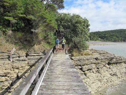
Boat lands at Te Akau Wharf Road
Ian Hardies' Raglan Harbour Tours boat drops Ramblers off at Te Akau Wharf Road - Image John Lawson

The Rekereke valley near Ruapuke has a rushing stream
The Te Rekereke Stream headwaters are on the south-western side of Mount Karioi, in native forest. This steep stream then flows to the Tasman Sea between Raglan and Ruapuke Beach. The main stem measures 26km in length and the catchment area is approximately 2 square kilometres. The catchment consists of mainly lowland topography and the stream passes through indigenous forest with areas of pastoral land – Image John Lawson

Large limestone stack at Makaka, south west of Raglan
This limestone large stack has ‘Hobbit’ caves behind it. They are in 28 million year old Orahiri Limestone. They are not far from the edge of the large Toreparu wetland. Image John Lawson

Reflections on Kaitoke walkway
View of Kaitoke Creek taken from Kaitole Walkway - Image John Lawson

View from Magic Mountain on Houchens Road, Te Mata
From Magic Mountain, a 327 metre trig point near Te Mata, there are views of Pirongia, Karioi, Aotea, Kawhia and Whaingaroa

Heretu cone is 175m high and can be seen from SH23
From the hill there are views to the Divvy and up the Cogswell Valley - Image John Lawson

Pakihi valley
Lava flow blocked the Pakihi valley about two million years ago. Since then the Pakihi has found its way through the limestone under the lava to re-emerge in a spring further down the valley. After heavy rain Lake Disappear forms to the north. There is this deep sink hole in between. Image John Lawson

Limestone arch on top of the Kapamahunga
Range
On the southern part of the Karamu Walkway - Image John Lawson

Coastal shoreline near Te Toto Gorge
Te Toto Gorge descends 300 metres steeply down to the beach, to the rocky cliff. The area was formed by layers of ash and lava., - Image John Lawson

View from Te Mata farm
View from a Te Mata farm with a glimpse of Raglan Harbour in the background- Image John Lawson

View south from Te Kaha Point
View south from Te Kaha Point with Mount Karioi in distance - Image John Lawson

On the walk there are good views, as well as the huge 130.5 m. high, 2.2MW turbines
Vandy Rd to windfarm – the shortest route to the top, but this old road, started in the 1890s, but never completed, hasn't been maintained since the 1930s. Image John Lawson

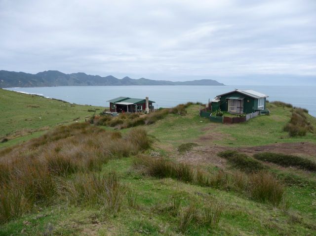
View of Raglan from Dreamview Farm
The Dreamview Farm and Creamery is at 430 Te Hutewai Road Raglan 3296 - Image John Lawson

Schnackenberg Bay, with access over the limestone pancake rocks into the bay at low tide.
Schnackenberg Bay, described in the Aotea history book, “as beautiful and quiet a spot as one could find anywhere.” Image John Lawson

The windfarm walk from the car park along Pipiwharauroa Way, is a chance of getting close to the 2MW, 130m high towers.
Pipiwharauroa Way is a long walk of about 18 km,
with easy walking on the access road and partly-formed road. Image John Lawson

Ruapuke/Waiau beach – there is a steep track to the beach
From the beach, there is an easy walk to Toreparu Stream and Matawha Point - Image John Lawson

View from Matakotea Stream valley
View on the Matakotea Stream valley walk with Te Uku Wind Farm in the background. Image John Lawson

View from Pearts Finger
On Pearts Finger near The Narrows, which join the Waitetuna to the rest of the harbour, there is a an old bach and lots of good views. Image John Lawson

WW2 Raglan defences - pillbox near the Kokiri Centre
With shifting sands and tree growth its is hard to find the Will we find the 1942 'Type 22' pillbox in amongst the pine trees.

Ed Hillary - Michael Hope Reserve
The reserve opened in 2015. Tracks are now being opened up, one with a bit of the old Raglan footbridge, which make it easier to get to the viewpoints, including overlooking SH23. Image John Lawson

Bridge on walkway from Ngarunui Beach to Bryant Reserve
New bridge - Image John Lawson

View from Kaitoke track
Estuary and mountain views from track - Image John Lawson
")
Lake Disappear in the dunes above Te Kaha Pt (Mussel Rock)
View of the lake which sometimes disappears with Mount Karioi in the distance. Image John Lawson

View of karioi from Te Mata to Magic Mountain walk
The 7km walk from Te Mata domain to Magic Mountain includes the 327m trig point with views of Pirongia, Karioi, Aotea, Kawhia, Whaingaroa. Image - John Lawson

Part of the Hillary Hope Reserve established in 2015
Image by John Lawson

Whaanga Coast by Te Toto Gorge
Image by John Lawson

Elephant Rock
Tidal rocks on the walk from Wainmu to Ngarunui Beach - Image John Lawson

Motukokako Scenic Reserve
Motukokako Point opposite Raglan Wharf is a steep and wooded 41 hectare reserve – Image John Lawson

Toreparu is one of Whaingaroa's 15 large waterfalls
The waterfall is beside a wall of basalt columns and above the large coastal wetland - Image John Lawson

On the Karamu Walkway there are views to Waikato, Pirongia and Whaingaroa
The southern part of the walkway is 7.8km, mostly on top of the Kapamahunga Range, with a limestone arch, a tomo, bush, and a river. Image John Lawson
")
Te Kaha Pt (Mussel Rock)
Te Kaha Pt (Mussel Rock) beach from top of a 60m high dune - Image John Lawson

Te Mata Farm
The rolling countryside near Te Mata Village - Image John Lawson

View from Mount Karioi
View from Mount Karioi on trapline route
Image John Lawson

View of Mount Karioi from Wainui Reserve
Carved sculptures in foreground - Image John Lawson

Raglan has six kilometres of sandy beaches
Raglan's beaches stretch from town to the Bryant Reserve – Image John Lawson

Ocean view from Wainui Reserve
Raglan bar and Tasman Sea with coast north of Raglan Harbour - Image John Lawson

Path in Wainui Bush Park
The sheltered bush park off Wainui Road has short walks in native bush and a green lawn area with picnic tables. The tracks connect with ones in the Wainui Reserve
Image John Lawson

View from Te Akatea Pongawhakatiki
The pointy hill behind Waingaro. Image - John Lawson

Waterfall near Te Mata
On the Raglan Ramblers walk of Te Mata farms - Image John Lawson

View from the Sweetman Farm
The Sweetman Farm is on the southern slopes of Karioi. There are views across the
bay to Albatross Pt. - Image John Lawson

Greenslade Road Beach views
Scenes from a walk on the beach below Greenslade Road - Image John Lawson

Log Cabin
Cabin near Heretu Cone - Image John Lawson

Ngarunui Beach, Raglan
Rocks peeping through the sand - Image John Lawson

View from Te Kaha Point of harbour, coast, sand dunes, mountain and Raglan.
Image - John Lawson

Views on Omahina Creek Walk
Omahina Creek is close to Raglan West. On the walk along the creek there are good views of the harbour and mountain. Image John Lawson

Limestone outcrop on Karamu Walkaway
The southern part of the Karamu Walkway is 7.8km, mostly on top of the Kapamahunga Range. Along the way sights include a limestone arch, a tomo, bush, a river and views to Waikato, Pirongia and Whaingaroa. Image John Lawson

Beach below Te Toto Gorge
Rocky foreshore of Te Toto Gorge meets the Tasman Sea - Image John Lawson

Kaitoke Walkway
The walkway starts follows Kaitoke Creek to Flax Cove – Image John Lawson

View of Mount Karioi and SH 23 from Karamu Walkway
Image John Lawson

Te Akatea
The Waingaro Rd side of Te Akatea , with views to Pongawhakatiki and other hills towards Glen Massey - Image John Lawson

Crags in Bridle Creek area
Bridle Creek is south east of Raglan - Image John Lawson

Sculpture in the Wainui Reserve
In its 140 hectare Wainui Reserve there are coastal views, the Wainui Stream and areas of bush. Image John Lawson

Hillary Hope Reserve
Trach sign in Hillary Hope Reserve - a new reserve established in 2015. Image John Lawson

Elephant Rock covered with sand
On Ngarunui Beach, sand levels change with time. At times Elephant Rock is covered and at other times it is fully visible. Image John Lawson

View of estuary and Raglan from Wainui Reserve
View of estuary and Raglan from near the pine forest in Wainui Reserve – Image John Lawson

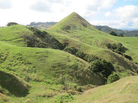
Heretu Cone
Heretu cone is 175 metes high with views to the Divvy and up the Cogswell Valley. Image John Lawson

Ruapuke Beach
Raglan Ramblers at Ruapuke Beach - Image John Lawson

Limestone stack on shore of Aotea Harbour
Image - John Lawson

Waterfall on Te Akau Wharf Road
Across the harbour by ferry from Raglan is Te Akau Wharf Road - Image John Lawson

Patikirua Bay and monument
Patikirua Bay and monument with Greenslade Rd in background – Image John Lawson

Pakoko Estuary
The picturesque, winding channel of Pakoko Estuary, where the river, which has come over Wāireinga/ Bridal Veil Falls, then merges into Aotea Harbour - Image John Lawson

The Narrows
View of The Narrows by Pearts Finger – Image John Lawson

Rushing stream at Wild Coast Ruapuke
Ramblers crossing stream - Image John Lawson

Landmark in Te Toto Gorge
Image - John lawson

Views of Raglan from Benseman Farm
A walk in the hills above Raglan

Views from Matira Farm, Waikato District
Image - John Lawson

Whaingaroa Harbour view from Lorenzen Bay beach next to the Doughboys
– Image John Lawson

Carters Beach
Carters Beach is a 3km walk from the Te Akau coast road to the Raglan Limestone blocks, which slope into the sea. There’s also a view of the coast to Karioi, about 17km to the south

Beach rocks on Ramblers' Greenslade Rd walk
Inner harbour beach rock formation and view North across the harbour - Image John Lawson
")
Te Kaha (Mussel Rock)
On west coast north of Raglan - Image John Lawson