SEVERE WEATHER WARNING.
ISSUED BY MetService AT 8:48am 01-Sep-2015
URGENT – IMMEDIATE BROADCAST IN: Nelson, Buller, Waikato, Bay Of
Plenty Rotorua
SEVERE EAST TO SOUTHEAST GALES ABOUT NELSON, BULLER AND NORTHERN
WESTLAND, EASING. HEAVY RAIN FOR WAIKATO, WESTERN BAY OF PLENTY AND
WESTERN NELSON.

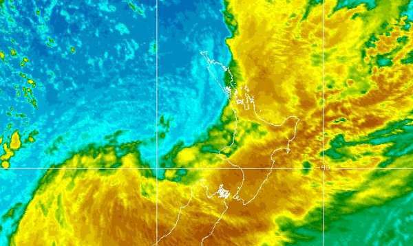
A deep low lying west of the North Island is expected to move over the South Island early Wednesday. Associated fronts are expected to
move across central and southern New Zealand today (Tuesday). These fronts are preceded by strong to gale easterly winds, with outbreaks of heavy rain expected about central parts of the North Island and the upper South Island. A SEVERE WEATHER WATCH is also in force for many parts of the country.
This Warning is for the following places:
Severe east to southeast gales gusting 130 km/h about Nelson west of about Motueka, Buller and northern Westland, especially about western places north of Westport, are expected to ease early this afternoon
(Tuesday). People are advised winds of this strength can damage structures, powerlines, and make driving hazardous.
In addition, heavy rain about the Kaimai Range, Bay of Plenty west of Whakatane, and Waikato is expected to ease early this afternoon (Tuesday), although a further 90mm is still likely about the Kaimai Range and western Bay of Plenty this morning. Heavy rain should ease about western Nelson this afternoon, with a further 70 to 100mm expected about the ranges. This rainfall may cause slips, surface flooding, and cause rivers and streams to rise rapidly.
FOR THE LATEST WEATHER AND FORECAST CHARTS PLEASE GO TO
http://metservice.com
MORE DETAILED INFORMATION FOR EMERGENCY MANAGERS FOLLOWS.
======================
HEAVY RAIN WARNING
======================
AREA AFFECTED: WAIKATO
FORECAST:
Heavy rain is expected to ease around midday today (Tuesday). In the
4 hours from 9am to 1pm today, expect a further 30 to 50mm about the
hills south of Hamilton, with 20 to 30mm elsewhere. Peak intensities
of 10 to 20mm/hr.
