
Sands of time by John Lawson – Continuing our occasional history series, we look back to Whāingaroa a century ago – 1923
Whāingaroa news in 1923 was dominated by transport issues, especially who would pay for the damage to the gravel and mud roads from lorries and cars, and whether a new narrow gauge railway would relieve the roads. 1923 became the year when the railway plan (first mooted as early as 1863) was defeated and plans for road upgrades began to be implemented. 1923 was also the year when, what is now Papahua Domain, came under the control of Raglan Town Board.
The Waitangi Tribunal has heard the various views about Papahua and will make a decision on what really happened, but in 1917 the Raglan Town Board resolved to “take steps to acquire” the area, even though it wasn’t until 1919 that the Native Land Court decided who owned it. In December 1923 the Waikato Times reported that the Board had just acquired Papahua No. 2 Block, noting that even then it was usually called Te Kopua (a name Waikato District formally changed it to Papahua Reserve in 2018). (Until World War 2, most Māori spoke te reo as their first language, which would have limited communication with government. For example, a Raglan man was convicted of attempted suicide (a crime until 1961), having defended himself in broken English.)
Conditions for the transfer included Papahua being a Public Reserve, Raglan Town Board getting no benefit from it, Pakeha and Māori having equal rights over the land and for a bridge to be built. Footbridge plans had been made in 1922, though the first one didn’t open until 1926. A bridge was important to those living along the coast; a native school site had been planned for Te Kopua in 1903, but never built, so their children still had to cross to the Stewart St school by ferry.
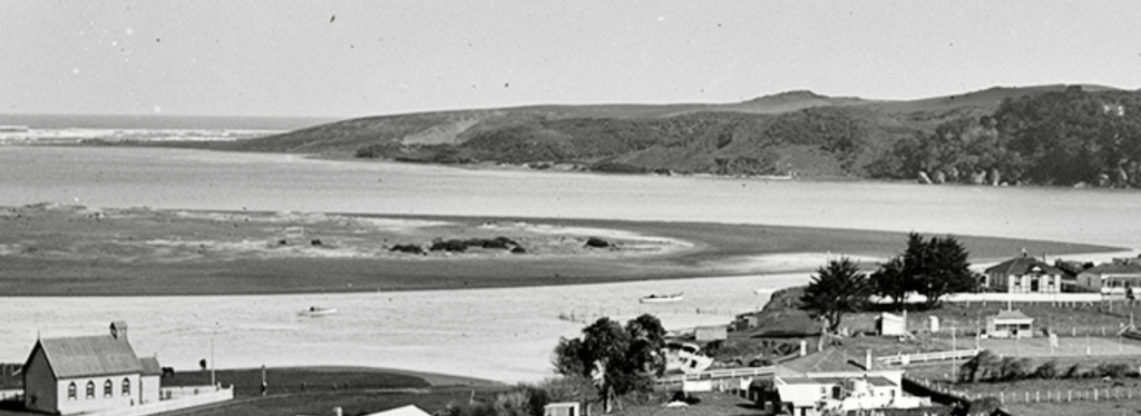
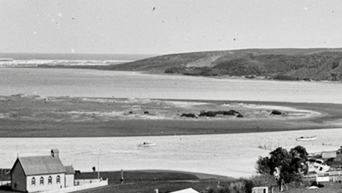
The 1911 bathing enclosure is near the larger boat. Tennis courts are on the right.
In 1923 Kenneth Wright was promoted from assistant to Raglan County Engineer. He retired in 1951. During that time motor cars and lorries came to dominate the roads and spending rose from £21,500 (equivalent to about $2.5m in 2022) a year to £105,200 (about $8m in 2022). In 1923 the 2,420 km2 Raglan County had 1,390km of roads (260 gravel, 750 mud and 380 tracks). Waikato District now covers 4,188 km2 and has 2,458km of roads (1,860 sealed, 598 gravel), costing ratepayers $38m a year.
In 1923 horse-drawn graders, spreading hand broken gravel, were replaced by trucks, excavators, graders and steam-powered crushers. Quarries were bought all over the County, including at Three Streams, Gibbison’s, 10 and 13 miles along the main road, Sheib’s (Te Mata), Rawlinson’s, Bell’s, Te Uku Landing, Waingaro Landing, Belcher’s and Nicholson’s, as well as taking gravel from beaches and streams.
Raglan’s average traffic, as counted about 2km from town in March, was around 11 local cars a day and 17 others. The population was about 300, but doubled in summer. An indication of the easing of travel was that Raglan played rugby against Kawhia in 1908 and 1913, but then in 1920, 1921, 1922 and 1923. In 1923, under the Highways Act of 1922, a Main Highways Board and No. 2 Group Highway District for South Auckland were set up. Half the cost of new roads came from the Board and half from ratepayers. A Government commissioner decided Hamilton had to contribute 19% of the costs of the Raglan road. Hamilton’s Mayor complained it wasn’t fair to have to pay for a road which was to be used by only a comparatively few favoured citizens with motor cars. He said Hamilton had not asked for the road to be improved, but many wealthy people now went to the seaside; about 1 in 20 people had a car. The Minister for Public Works, Gordon Coates, had set up the system, but said, “It is not for me,” adding that it had been investigated by an impartial commissioner.
Several reports talked of large numbers of visitors in Raglan. Some were attracted by the fishing, one report saying, “Last week a party secured 170 large schnapper in an hour’s fishing.” Sunday char-a-banc trips from Hamilton to Raglan were well patronised.
Counties tried to recover some money by charging carriers 6d per 100 ft of timber and licensing lorries for £20 to £50 a year. However, carriers objected to paying a fee to each authority and magistrates found reason not to apply them. For example, one asked why the Council wasn’t represented by counsel, saying he’d have to do the work which should have been done by the county solicitor. He then said there was no evidence that the carrier was plying for hire and dismissed the case. Matakowhai ratepayers objected to paying for the distant Raglan-Whatawhata road, but the court ruled against them. Similarly the government commissioner rejected toll gates, saying they were an anathema to motorists.
Raglan County’s extra rate to cover a loan of £4000 to repair the Raglan-Whatawhata road was carried by 247 to 85 votes. Campbell Johnstone was chairman of Raglan County, but also a major shareholder in Campbell Coal, created as a company in 1923. It mined a 14 feet coal seam, opened in 1922, close to the main road, near Heddon Rd, Whatawhata. The mine closed when Hamilton gasworks was replaced by a gas pipeline on 25 March 1970. A wooden tramline from the mine to the road had horse drawn trucks emptying their loads at a small siding, where lorries were loaded. There were complaints that the road was very good before the mine was opened, and was still good on the Raglan side, but that cars were getting stuck near the mine, which paid only small amounts for maintenance.