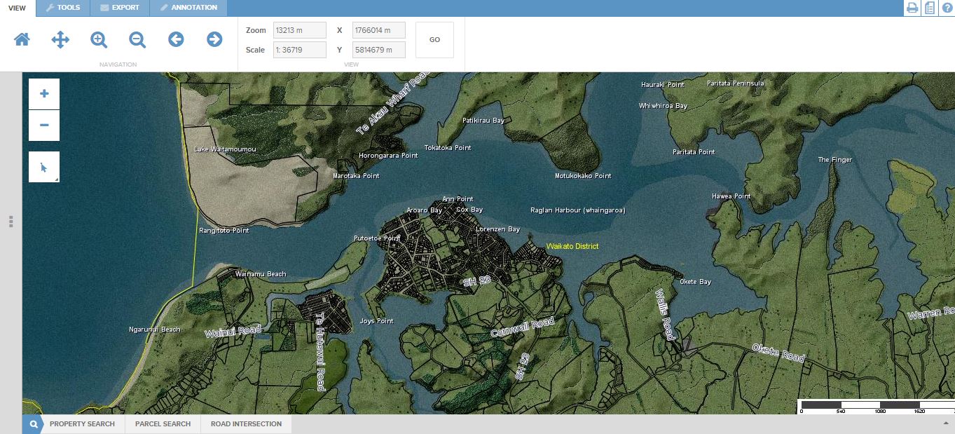
This morning Monday 13th July, Waikato District Council announced a new Maps Online system covering Raglan and other parts of the Waikato District.
I thought it deserved a test drive so had a look at how Raglan came up. The detail on the aerial views is much clearer and more up to date than what’s on Google maps. At times pages do take al long time to load and sometimes I could only get them to load after multiple attempts. Overall it looks good apart from one error about Putoetoe Point. (Putoetoe is the original name for the Raglan Town area. Today the former redoubt site in Wi Neera St and Putoetoe Point are the only uses of the name.) On the online map Putoetoe Point had migrated from its location on Cliff St across the estuary to the sand-spit by the skatepark.
I asked WDC about the apparent error. A spokesperson said:
“With regard to the incorrect placement of Putoetoe Point, this data set is sourced from LINZ and it appears that we have a data set that has Putoetoe Point incorrectly placed. We have manually reassigned Putoetoe Point to the correct location in the short-term and we will source a corrected data set from LINZ and make it available on our maps viewer.
We make every endeavour to ensure that the information we publish is correct and up to date but as the site disclaimer says we cannot guarantee the accuracy of the information supplied. We encourage users of the site to identify inconsistencies so we can address them where appropriate.
Thanks again for pointing this out.”
So if you do spot an error please let the Council know so it can be fixed.
Media Release: Waikato District Council, 13 July 2015
Waikato District Council launches Maps Online
Waikato District Council has launched its external map viewer. The new software which went live on Council’s website today, allows customers to view and search for:
- a property
- property and road boundaries
- property and rating information
- District Plan information
- utilities information (water, wastewater and stormwater)
- aerial photography.
Tony Whittaker, General Manager Strategy and Support, is excited about what the new map viewer offers to customers, “Maps Online gives our customers access to an incredible wealth of information. Our aim is to have all the information we collect about Waikato district available to our customers through the website.”
“Council has been using mapping tools internally to manage assets and deliver services for some time but this is the first time interactive maps are being made available to the public. The viewer is designed to be user-friendly for everyone and allows users to overlay a range of Waikato specific property, services and recreational information on top of birds-eye view maps.”
Maps Online has many features familiar to people who use Google Maps or Google Earth. It also offers other key features including the ability to annotate or make notes on maps.
“Users can add text and shapes to maps, measure distances and mark areas to say for example, ‘this is where the new shed will be,’” explained Mr Whittaker.
“We’re experiencing high development and growth in certain areas. The information available in Maps Online will be updated regularly to reflect changes in our district” Mr Whittaker said.
Some aerial photography in the map viewer is as recent as a few months. The latest aerial photos of Pokeno were captured using new drone technology which delivered top quality, hi-resolution photography.
Council’s Geographic Information System (GIS) team manages all of Council’s spatial information and will continually update the map viewer to keep up with the changing face of Waikato district.
Now all of the Waikato district can be seen via one public map viewer which can be found at http://www.waikatodistrict.govt.nz/Online-Services/Maps-online.aspx

