{SWW Event 2017/11.4}
NOT TO BE BROADCAST AFTER 09:00pm Wednesday 08-Mar-2017
SEVERE WEATHER WARNING.
ISSUED BY MetService AT 9:58am 08-Mar-2017
URGENT – IMMEDIATE BROADCAST IN: Coromandel Peninsula, Bay Of Plenty,
Rotorua, Gisborne, Auckland, Northland, Waikato
HEAVY RAIN FOR THE CENTRAL AND UPPER NORTH ISLAND.
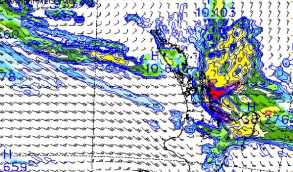
A low over the Tasman Sea extends slow moving fronts over northern New Zealand, which have brought heavy rain to the northeast of the North Island. Rain should continue today and tomorrow. The heaviest
falls are likely to be in Northland, Auckland, Coromandel Peninsula, Bay of Plenty and Gisborne. A further 60 to 90mm of rain could accumulate in a relatively brief period today, with localised thundery downpours. The initial burst of rain should ease this afternoon, but further rain is expected during Thursday and Friday,
particularly in Northland and the Coromandel Peninsula, where a further 80 to 180mm could accumulate.
Rainfall in these areas can produce flash flooding and cause rivers and streams to rise rapidly. It can also lead to adverse conditions for motorists.
People in the North Island are advised to keep up to date with the latest forecast and warnings.
FOR THE LATEST WEATHER AND FORECAST CHARTS PLEASE GO TO
http://metservice.com
MORE DETAILED INFORMATION FOR EMERGENCY MANAGERS AND TECHNICAL USERS
FOLLOWS.
===============================
WARNINGS NO LONGER IN FORCE
===============================
HEAVY RAIN WARNINGS HAVE BEEN LIFTED FOR: WAIKATO
NEXT SEVERE WEATHER WARNING WILL BE ISSUED AT OR BEFORE
9:00pm Wednesday 08-Mar-2017
