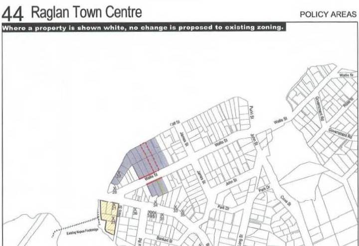
The plan to build a ring road in Raglan has been dropped in the final draft version of the Raglan Structure Plan approved at this weeks’ meeting of the Waikato District Council. The seemingly bizarre ring road has been replaced by a proposed heritage zone in the area bounded by Wi Neera St, Bow Street and the harbour.
But the question might be asked, “Is this a case of closing the stable door after the horse has bolted?” , as many historic buildings have already been demolished or removed in this area. Council plans to widen Wi Neera Street would remove its appeal as a heritage narrow lane. The old Anglican Church (Vinnies), Smith’s Store (Hong Kong Kitchen) and No.1 Bow St have been heavily modified. The remaining important heritage buildings in the area are the old Gilmour store (Blacksand) and No. 1 Wi Neera Street. The Structure Plan does see No. 1 Wi Neera Street added to the heritage list. The proposed heritage zone was initially known as ‘The Green’ or the Government area when the town area of Raglan was established. The area is of cultural significance to Ngati Mahaanga. Wiremu Neera Te Awaitaia had a house in the area and his memorial was located here before it was moved to Te Kopua.
The proposal focuses development of the business area of the town in the Wallis Street and Cliff Street area. The current living zone is be rezoned as a business zone. A new road is proposed from Wallis Street to Cliff Street to allow this new area to develop. It is envisaged that the new area would develop with parking controls, verandahs and rear service lanes. In Raglan’s early 19th century days, the Cliff Street area was then a main area for hotels and stores. So this is a case of back to the future! The idea being to leave the current Bow Street area to remain much the same as it is now, retaining its heritage character.
The many alternatives suggested in the early draft for industrial development have been rejected in favour of the existing industrial subdivision known as Tasman Lands. The plan proposes that this area, located 3.7 kilometres away from Raglan on SH23 near the Okete Road, is zoned as light industrial. Currently there is a small concrete batching plant operating in the subdivision.
Council staff have been working on the plan for two years. It is based on meeting a population increase of 61 per cent during the next 50 years, although some Councillors are sceptical that growth would be so low. The plan will now be notified as an amendment to the Waikato District Plan.