
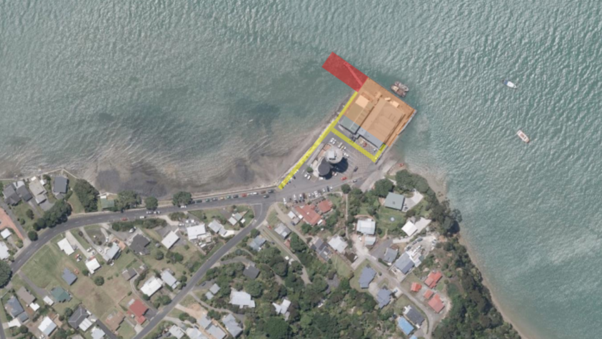
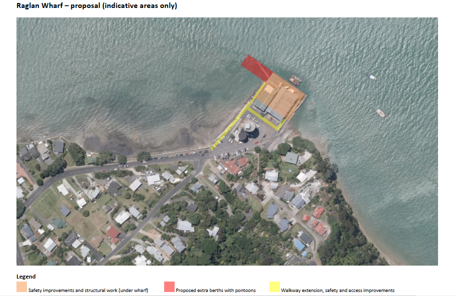
making way for a walkway (yellow) in front of the Raglan Wharf buildings
The indicative proposal for a Wharf walkway is part of a package of improvements for Raglan Wharf that WDC put to the Regional Growth Fund. An aerial drawing given to Raglan Community Board shows a walkway from the end of the existing Cliff Street footpath along the harbour edge next to the existing road. At Tony Sly Pottery the walkway divides with one leg going along the front of the pottery shop, the public toilets, the Coast Guard and the Soul leather shop. To implement the walkway would eliminate the parking spaces in this area. This area at the moment works as an undesignated mixed use zone shared by cars and pedestrians. The Council information says that as part of the Council’s co-funding requirement, work will be undertaken to explore parking and access improvements along Wallis Street and Aro Aro Park. So it appears that the lost parking spaces may be replaced by ones near John Street.
The Council media release about the project said that the work would be funded by a $2.5 million Government grant. Information supplied to the Raglan Community Board shows that the Government grant will only fund part of the project cost. The Board was told that another $630,000 would be funded from ground rents collected by the Council from the Raglan Harbour Reserve Estate. (The leasehold properties in the area bounded by Opotoru Estuary, Bow Street and Wainui Road). All ground rent income until 2025 would be required to cover this expenditure.
The indicative work also includes changes to the narrow fishing pier with it being replaced by a wide pier (shown red on drawing) with a floating pontoon attached. At a meeting on 3rd June the Council said they planned the setting up of subgroups to get pontoons built by Christmas and consider a walkway.