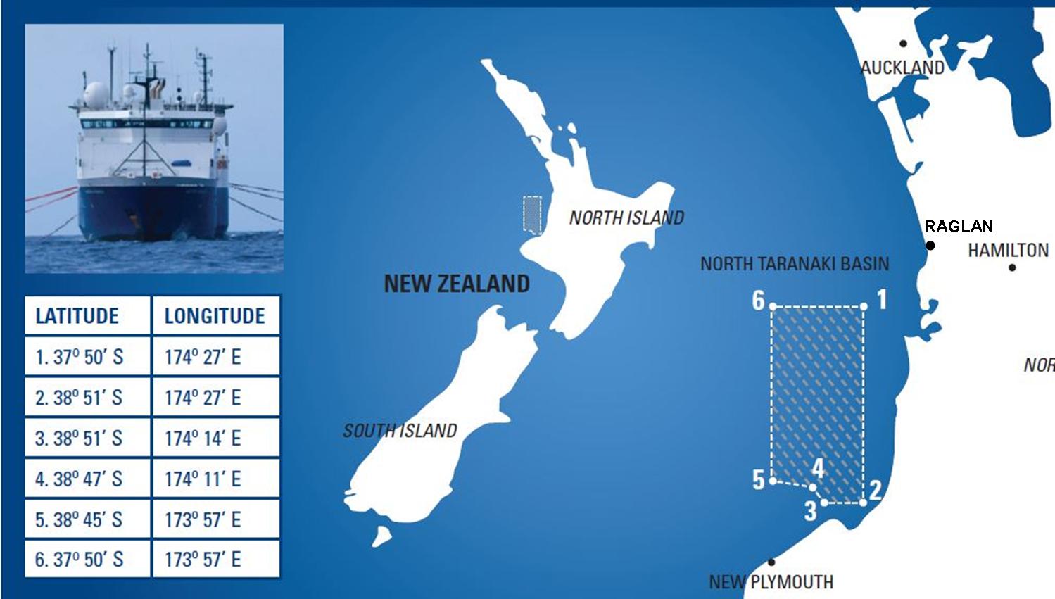
 Locals are concerned about a seismic study to be undertaken in early 2003 offshore of Raglan over a 4000sq km area with a huge ship with trailers 8 km long and 900m wide.
Suz Hall says that this seismic testing will be right through our fishing area and the Maui dolphin’s territory for the next 4 months. She has written to DOC to ask for more info.
Share has found so far that Fisheries said that local iwi were told, but in the WesternGeco Information sheet says that during last year “an independent expert advisor was appointed to conduct a detailed environmental impact study of the Taranaki basin, which included extensive discussions with relevant authorities and local communities.” (WesternGeco does not appear to have a NZ office…the number listed online is no longer registered to them)
Suz would be interested to hear if any of you were consulted?
She has looked into this type of seismic survey and found that research overseas shows that seismic testing does kill sea mammals, and also fish eggs and larvae. There is a lot of info about a similar proposed seismic testing in Diablo Canyon, USA. That application was actually rejected in Nov 2012, partly because of the negative effect it would have on endangered sea mammals, and their food source in that area.
The company who was looking at doing the testing in that area actually offered fishing industry compensation before testing, as it was known that catch rates could drop by up to 50% in the first year of testing as fish disperse to avoid the sonic booms.
Has our local fishing industry been offered similar compensation?
How will this not impact Maui dolphins??
I would be interested to know if any of you have further information on this.
Regards
Suz Hall
Media Release: WesternGeco
Taranaki Basin Seismic Survey- Information for the local community
WesternGeco, a leading geophysical services company, is conducting a 4,000 km2 geophysical survey in the North Taranaki basin offshore New Zealand in early 2013 to gather geological information on potential oil and gas reservoirs. The survey is being conducted under a permit from New Zealand Petroleum and Minerals and plays an important role in the New Zealand government’s plan to create jobs and growth through unlocking the area’s petroleum potential.
The survey area will extend from north offshore Motonui in North Taranaki up to offshore Raglan. The survey will be conducted by the vessel Western Monarch, with support vessels Pacific Parrot and Ocean Pioneer. Weather permitting, the project should take between three and four months to complete. Environmental responsibility WesternGeco understands its environmental responsibilities and is a leader in conducting safe geophysical operations in environmentally sensitive areas.
In 2012, an independent expert advisor was appointed to conduct a detailed environmental impact study of the Taranaki basin, which included extensive discussions with relevant authorities and local communities. WesternGeco will implement comprehensive environmental protection measures that exceed those required by the Department of Conservation (DOC) 2012 Code of Conduct for Minimising Acoustic Disturbance to Marine Mammals from Seismic Survey Operations.
About WesternGeco
WesternGeco has more than 80 years’ experience providing seismic data acquisition, processing and imaging services to the oil and gas industry. We have conducted successful marine geophysical surveys in Australia, the Arctic, Asia, North America, Latin America, Europe and Africa, including in some of the world’s most environmentally sensitive areas.


It was just reported that the ban on gathering shell fish has been removed from Raglan Harbour but now this.